Formation flightsBeech T-34 Mentor
Beech T-34 Mentor N13T flies close to an Aero L-39 Albatros
The pair was recorded near Howell, Michigan, with a closest horizontal spacing of 0.013 nautical miles.
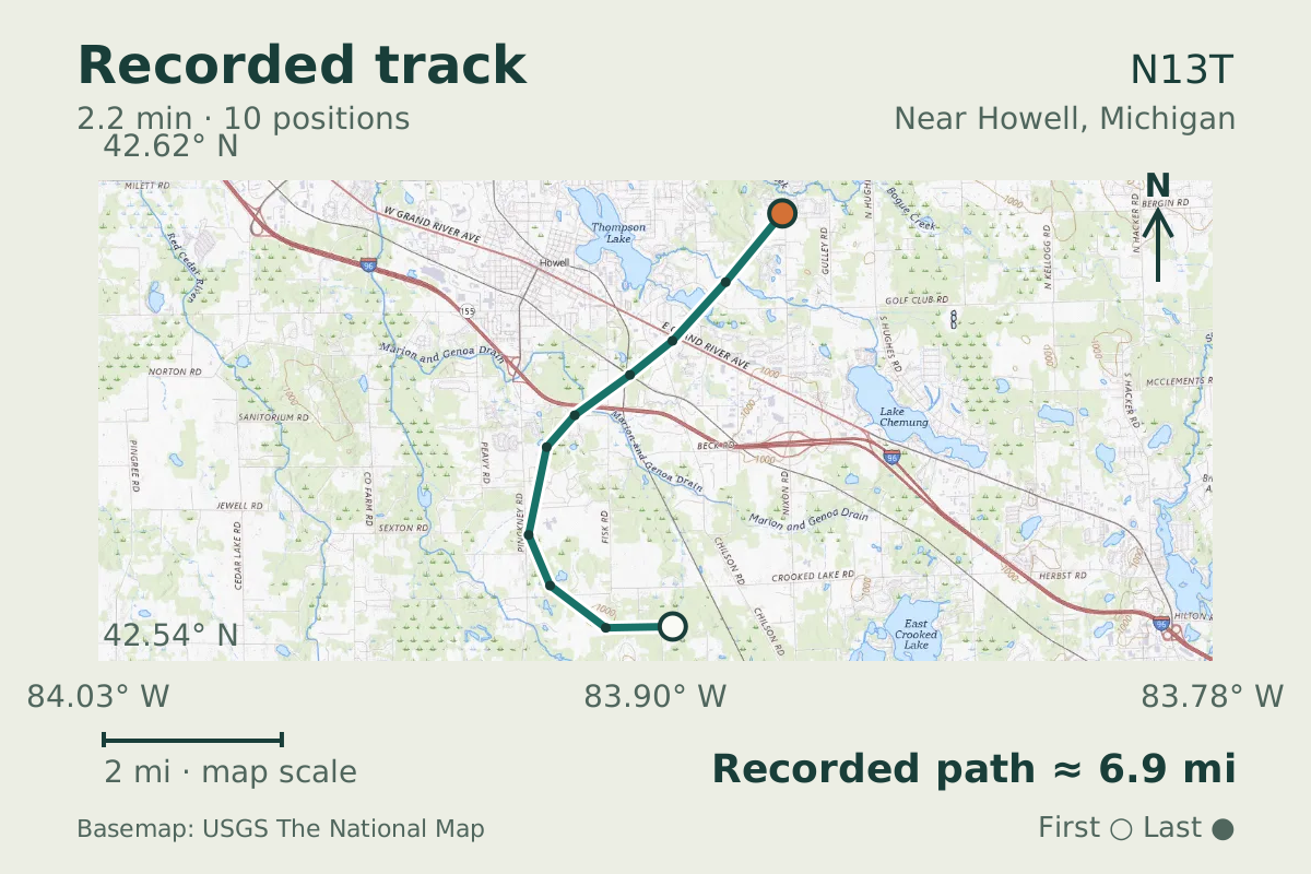
- Replay time · UTC
- —
- Last saved report · UTC
- —
- Recorded path
- —
- Reported ground speed
- —
- Archived altitude
- —
The dot moves between saved positions. Readings are from the last saved report. Recorded path is approximate and excludes gaps. Distances use nautical miles (nmi); speed uses knots (nmi per hour).
Beech T-34 Mentor N13T and Aero L-39 Albatros N939TS flew close together near Howell, Michigan, on June 3, 2026. The aircraft database lists those registrations and types. Their recorded positions put the pair just 0.013 nautical miles apart horizontally at their closest approach, with a vertical separation of 125 feet.
The database lists N13T as built in 1958, making the Mentor 68 years old at this observation. Its close encounter with the L-39 lasted 135 seconds. These positions came from saved archive tracks: the proximity is consistent with formation flight, but the data cannot establish coordination or intent.
Recorded data for N13T
| Observed | to |
|---|---|
| Event type | Flight patterns |
| Recorded source | ADS-B, ICAO address |
| Post date | |
| Last revised |
| Aircraft type | BEECH T-34 Mentor |
|---|---|
| Type designator | T34P |
| Tail number (registration) | N13T |
| Callsign | N13T |
| ICAO address | A07A81 |
| Other aircraft | N939TS · L39 ICAO address AD08D2 Source: ADS-B, ICAO address Closest horizontal separation between the aircraft: 0.013 NM Vertical separation at closest approach: 125 ft |
|---|
Measurements
Displayed measurements may be rounded.
| Ground speed | 159.6 kn |
|---|---|
| Archived altitude; reference not retained | 4,600 ft |
| Callsign | N13T |
|---|---|
| Transponder code | 1200 |
| Closest horizontal separation between the aircraft | 0.013 NM |
|---|---|
| Vertical separation at closest approach | 125 ft |
| Aircraft involved | 2 aircraft |
| Episode duration | 135 s |
| Telemetry samples | 10 samples |
Record details
Public event ID: 23444702-909b-49.
Record revision: 3.
Evidence version: 4e2b7d0b47be0a28.