Vintage aircraftBoeing-Stearman Kaydet
The 1943 entry behind Boeing-Stearman Kaydet N67895's flight
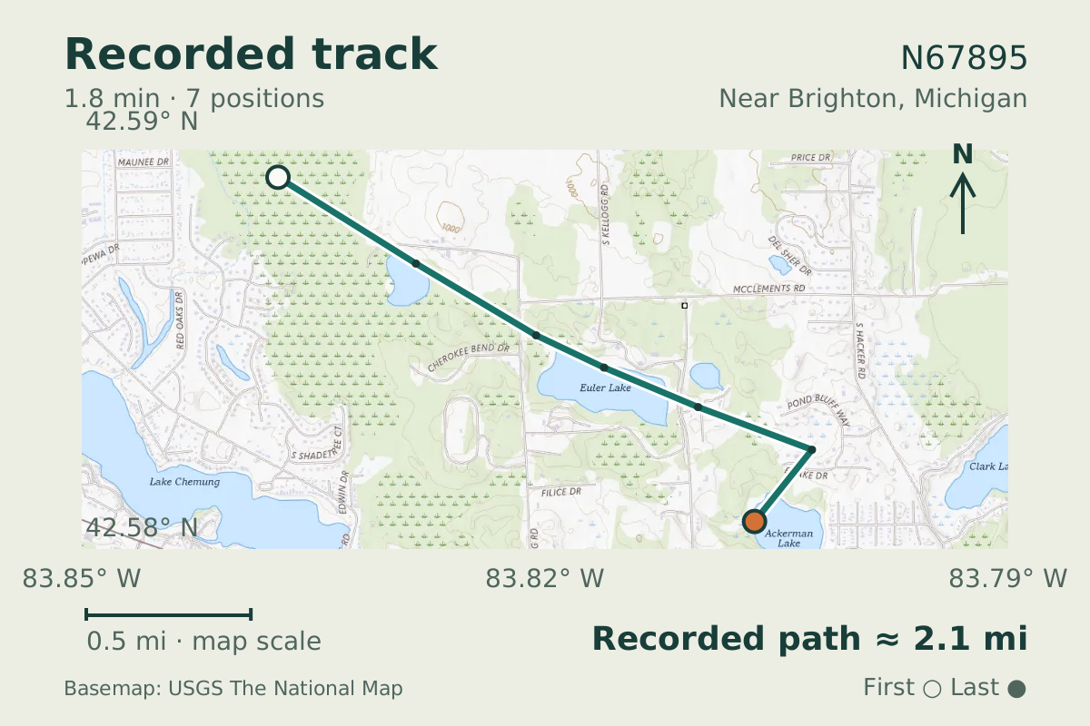
N67895 was reported near Brighton, Michigan, on June 26, 2026. Its listed build year puts the airframe at 83 years old.
- Replay time · UTC
- —
- Last saved report · UTC
- —
- Recorded path
- —
- Reported ground speed
- —
- Archived altitude
- —
The dot moves between saved positions. Readings are from the last saved report. Recorded path is approximate and excludes gaps. Distances use nautical miles (nmi); speed uses knots (nmi per hour).
Boeing-Stearman Kaydet N67895 flew near Brighton, Michigan, in a flight recorded on June 26, 2026. The aircraft database lists its build year as 1943, putting the airframe at 83 years old. A recorded ground speed of 79 knots and altitude of 2,400 feet provide a brief picture of that flight.
The Kaydet's construction is worth picturing alongside those readings. Its wooden wings are covered with fabric, while its fuselage uses welded steel. The type is a two-seat biplane, and every Kaydet version used a radial engine. The listed year gives this particular aircraft its vintage context.
About the Boeing-Stearman Kaydet
- The Boeing Stearman Kaydet is a two seat biplane.
- The Kaydet has wooden wings covered with fabric.
- Its fuselage uses welded steel construction.
- All Kaydet versions used radial engines.
Recorded data for N67895
| Observed | to |
|---|---|
| Event type | Unusual aircraft |
| Recorded source | ADS-R relay, ICAO address |
| Post date | |
| Last revised |
| Aircraft type | STEARMAN Kaydet |
|---|---|
| Type designator | ST75 |
| Tail number (registration) | N67895 |
| ICAO address | A8FD21 |
Measurements
Displayed measurements may be rounded.
| Ground speed | 78.6 kn |
|---|---|
| Archived altitude; reference not retained | 2,400 ft |
Record details
Public event ID: 67fa94fd-79ee-42.
Record revision: 3.
Evidence version: 9d98d4428d99adcf.