High-altitude balloonsReception source: ADS-B, ICAO address
Slow-moving N930TH could have been a high-altitude balloon
A reported altitude of 65,100 feet accompanied the slow movement. The record carried callsign HBAL837.
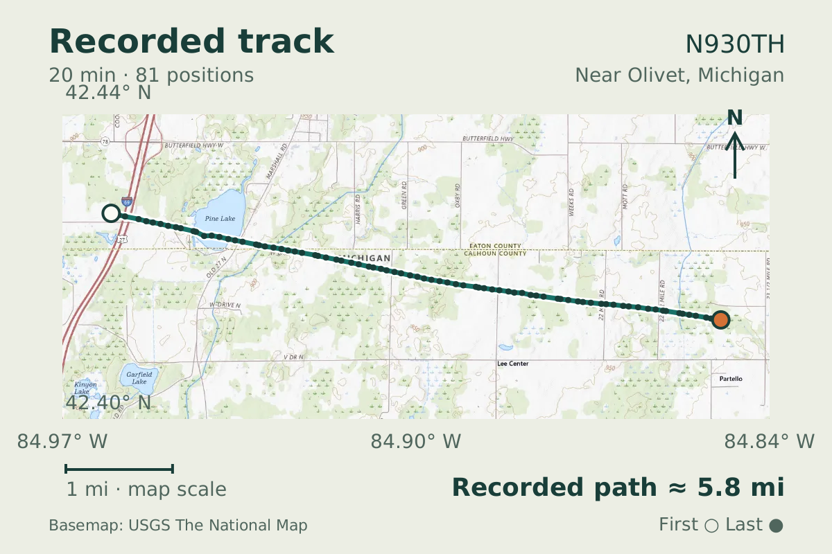
- Replay time · UTC
- —
- Last saved report · UTC
- —
- Recorded path
- —
- Reported ground speed
- —
- Archived altitude
- —
The dot moves between saved positions. Readings are from the last saved report. Recorded path is approximate and excludes gaps. Distances use nautical miles (nmi); speed uses knots (nmi per hour).
A slow-moving flight near Olivet, Michigan, reached a reported altitude of 65,100 feet on October 2, 2026. Ground speed along the track ranged from 13 to 20 knots. The reports were consistent with a high-altitude balloon, though the data do not establish who launched it or why it flew. Across 81 positions, the track covered 5.05 nautical miles, describing a short stretch of movement at that reported height.
For the aircraft transmitting address ACE75A, the aircraft database supplied the registration N930TH. HBAL837 was the callsign carried by the record. That gives the observation both a database registration and a separate callsign label: N930TH identifies the database entry, while HBAL837 is the name carried in the record's callsign field.
Recorded data for N930TH
| Observed | to |
|---|---|
| Event type | Unusual aircraft |
| Recorded source | ADS-B, ICAO address |
| Post date | |
| Last revised |
| Tail number (registration) | N930TH |
|---|---|
| Callsign | HBAL837 |
| ICAO address | ACE75A |
Measurements
Displayed measurements may be rounded.
- Ground speed
- 15.3 kn
- speed over the ground; wind adds to or subtracts from it
All measurements and the evidence record
| Ground speed | 15.3 kn |
|---|---|
| Archived altitude; reference not retained | 65,100 ft |
| Callsign | HBAL837 |
|---|---|
| Transponder code | 4455 |
| Median ground speed | 15.1 kn |
|---|---|
| Highest altitude | 65,100 ft |
| Episode duration | 1,200 s |
| Telemetry samples | 81 samples |
Evidence version: f4715d4b9542b887.
Record details
Public event ID: c4fcd482-eeda-4c.
Record revision: 9.