Rapid descentsBombardier CRJ700Reception source: ADS-B, ICAO address
Bombardier CRJ700 N712SK records a 6,080 ft/min descent
The jet was moving at 410 knots during the peak descent reading, with a SkyWest callsign in its transmissions.
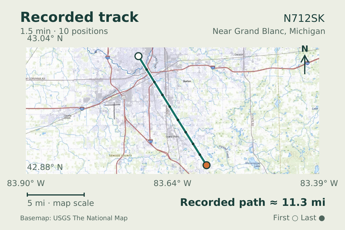
- Replay time · UTC
- —
- Last saved report · UTC
- —
- Recorded path
- —
- Reported ground speed
- —
- Archived altitude
- —
The dot moves between saved positions. Readings are from the last saved report. Recorded path is approximate and excludes gaps. Distances use nautical miles (nmi); speed uses knots (nmi per hour).

Near Grand Blanc, Michigan, a regional jet's reported descent reached 6,080 feet per minute. N712SK, identified as a Bombardier CRJ700 in its aircraft database entry, had a ground-speed reading of 410 knots at the peak. The observation was on October 31, 2026.
The transmissions carried callsign SKW4274, using the SkyWest Airlines designator. A fast descent in these reports does not establish an emergency. The altitude readings also showed a loss of 6,200 feet, giving context beyond the peak vertical-rate report.
The CRJ700 first flew in May 1999. The type shares significant design features with the CRJ100 and CRJ200, with greater range and passenger capacity. That family relationship is part of the background to this regional jet's design.
About the Bombardier CRJ700
- Bombardier launched the CRJ700 development program in January 1997.
- The CRJ700 first flew in May 1999.
- The CRJ700 shares significant design features with the CRJ100 and CRJ200, with greater range and passenger capacity.
Recorded data for N712SK
| Observed | to |
|---|---|
| Event type | Performance |
| Recorded source | ADS-B, ICAO address |
| Post date | |
| Last revised |
| Aircraft type | BOMBARDIER Regional Jet CRJ-700 |
|---|---|
| Type designator | CRJ7 |
| Tail number (registration) | N712SK |
| Callsign | SKW4274 |
| ICAO address | A98515 |
Measurements
Displayed measurements may be rounded.
- Peak signed vertical rate
- -6,080 ft/min
- the fastest rate in the episode; negative is down
- Observed altitude change
- -6,200 ft
- height lost or gained over the episode
- Episode duration
- 1 min 30.3 sec
- how long the detected episode lasted, which can be shorter than the saved track
- Ground speed
- 409.8 kn
- speed over the ground; wind adds to or subtracts from it
- Pressure altitude
- 13,850 ft
- pressure altitude, the figure pilots and controllers use
All measurements and the evidence record
| Ground speed | 409.8 kn |
|---|---|
| Pressure altitude | 13,850 ft |
| Geometric altitude | 14,250 ft |
| Geometric-altitude vertical rate | -6,080 ft/min |
| Navigation integrity category | 8 |
| Navigation accuracy category | 10 |
| Transponder code | 2477 |
| Episode start altitude | 17,050 ft |
|---|---|
| Episode end altitude | 10,850 ft |
| Distinct reports after collapsing repeats | 10 samples |
| Episode duration | 90 s |
| Telemetry samples | 10 samples |
| Median rate of readings above the detection threshold | -5,568 ft/min |
| Average rate from the episode altitude change | -4,119.6 ft/min |
| Observed altitude change | -6,200 ft |
| Integrated reported altitude change | -6,234.7 ft |
| Peak signed vertical rate | -6,080 ft/min |
|---|
| Detection threshold (magnitude) | 4,500 ft/min |
|---|
| Duration of consecutive reports above the detection threshold | 50 s |
|---|---|
| Consecutive reports above the detection threshold | 6 samples |
Evidence version: e4c7fbb0b86cb5b6.
Record details
Public event ID: 28c0bddf-dbd1-46.
Record revision: 2.