Notable aircraftBoeing P-8 PoseidonReception source: ADS-B, ICAO address
Plane Alert DB names 170478 as a Boeing P-8A Poseidon
The aircraft database gives the broader Poseidon name; the watchlist adds a Navy association and a maritime patrol tag.
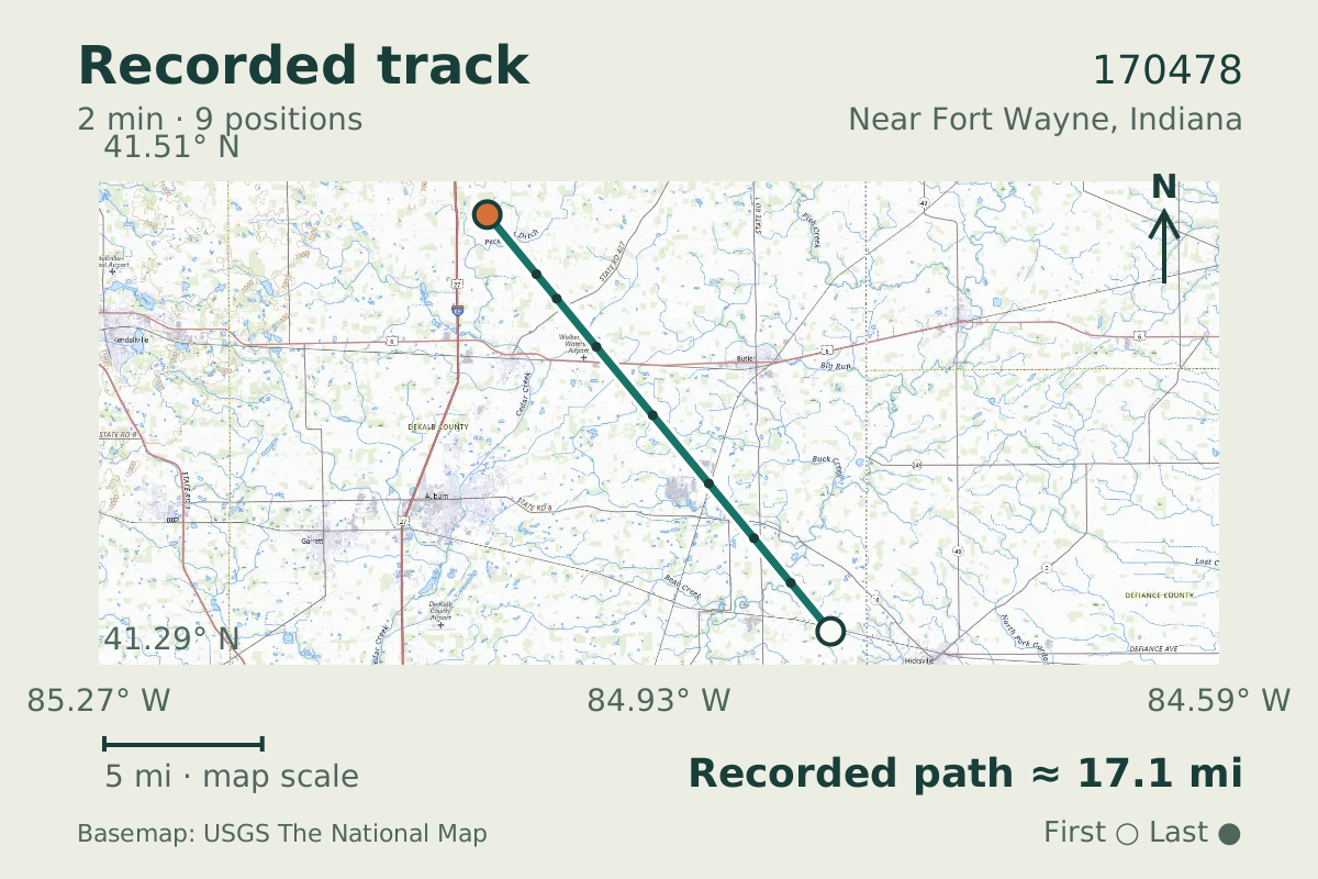
- Replay time · UTC
- —
- Last saved report · UTC
- —
- Recorded path
- —
- Reported ground speed
- —
- Archived altitude
- —
The dot moves between saved positions. Readings are from the last saved report. Recorded path is approximate and excludes gaps. Distances use nautical miles (nmi); speed uses knots (nmi per hour).

The P-8A description comes from Plane Alert DB, whose entry associates 170478 with the United States Navy. The aircraft database lists the jet as a Boeing P-8 Poseidon. It was tracked near Fort Wayne, Indiana, on September 10, 2026, with an altitude reading of 32,000 feet.
The watchlist association does not establish the operator of this flight. Its entry includes "Maritime Patrol" and "Eye In The Sky" tags. For context on the type, the original Poseidon variant first flew on April 25, 2009.
About the Boeing P-8 Poseidon
- Boeing builds the Poseidon aircraft family.
- The original Poseidon variant first flew on April 25, 2009.
Recorded data for 170478
| Observed | to |
|---|---|
| Event type | Unusual aircraft |
| Recorded source | ADS-B, ICAO address |
| Post date | |
| Last revised |
| Aircraft type | BOEING P-8 Poseidon |
|---|---|
| Type designator | P8 |
| Tail number (registration) | 170478 |
| ICAO address | AE749D |
Measurements
Displayed measurements may be rounded.
- Ground speed
- 421.2 kn
- speed over the ground; wind adds to or subtracts from it
All measurements and the evidence record
| Ground speed | 421.2 kn |
|---|---|
| Archived altitude; reference not retained | 32,000 ft |
Evidence version: 2be60688c46a8b9e.
| Source | Plane Alert DB |
|---|---|
| Association | United States Navy |
| List category | United States Navy |
| Tags | One Ping Only Vasily, Maritime Patrol, Eye In The Sky |
| Group | military |
| Listed aircraft | Boeing P-8A Poseidon |
| Entry link | https://w.wiki/3qBW |
| Category | Curated aircraft entry |
| Pinned source version | 6f7a19044a8dc9ed |
| Attribution | Aircraft association/category: Plane Alert DB / SDR-Enthusiasts and contributors. |
| Licences | Open Database License 1.0; Database Contents License 1.0 |
| Scope | Source association only; not verified current ownership, operator, historical association, or presence of any person aboard. |
Record details
Public event ID: 64b8b234-0594-40.
Record revision: 10.