Notable aircraftBoeing E-3 SentryReception source: Multilateration (MLAT)
Boeing E-3 Sentry adds a rotating radar dome to an airliner shape
A Sentry recorded near Ithaca, Michigan, traces its design to a commercial airframe, with a conspicuous radar dome above the fuselage.
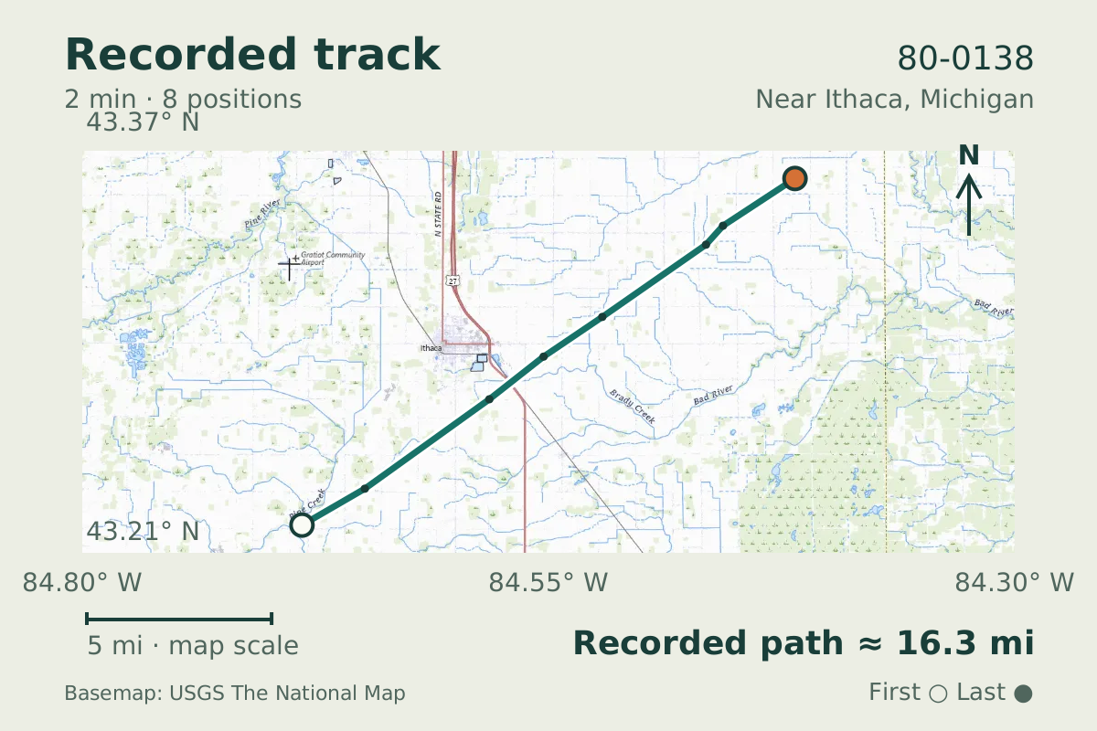
- Replay time · UTC
- —
- Last saved report · UTC
- —
- Recorded path
- —
- Reported ground speed
- —
- Archived altitude
- —
The dot moves between saved positions. Readings are from the last saved report. Recorded path is approximate and excludes gaps. Distances use nautical miles (nmi); speed uses knots (nmi per hour).
The Boeing E-3 Sentry's rotating radar dome sits above a fuselage derived from a commercial airframe. An example recorded in flight on August 12, 2026, was 80-0138, which the aircraft database identifies as a Boeing E-3 Sentry. Its track passed near Ithaca, Michigan.
Boeing says the type's development involved more than a decade of competitive fly-offs, prototype design, and development before entering U.S. Air Force service. Plane Alert DB describes this particular aircraft as a Boeing E-3G Sentry and gives its entry the tags "AWACS" and "Airborne Early Warning".
About the Boeing E-3 Sentry
- The E-3 Sentry takes the basic shape of a Boeing 707/320 commercial airframe and adds a conspicuous rotating radar dome above the fuselage.
- The E-3's development involved more than a decade of competitive fly-offs, prototype design, and development before the first aircraft entered U.S. Air Force service in 1977, according to Boeing.
Other Boeing E-3 Sentry stories

Recorded data for 80-0138
| Observed | to |
|---|---|
| Event type | Unusual aircraft |
| Recorded source | Multilateration (MLAT) |
| Post date | |
| Last revised |
| Aircraft type | Boeing E-3G Sentry |
|---|---|
| Type designator | E3TF |
| Tail number (registration) | 80-0138 |
| ICAO address | AE11EB |
Measurements
Displayed measurements may be rounded.
- Archived altitude; reference not retained
- 30,050 ft
- an archived altitude whose reference, pressure or GPS, was not kept
All measurements and the evidence record
| Archived altitude; reference not retained | 30,050 ft |
|---|
Evidence version: 5d324309af23c2fb.
| Source | Plane Alert DB |
|---|---|
| Association | USAF |
| List category | Oxcart |
| Tags | Eye In The Sky, AWACS, Airborne Early Warning |
| Group | military |
| Listed aircraft | Boeing E-3G Sentry |
| Entry link | https://w.wiki/DixY |
| Category | Specialized military aircraft |
| Pinned source version | 6f7a19044a8dc9ed |
| Attribution | Aircraft association/category: Plane Alert DB / SDR-Enthusiasts and contributors. |
| Licences | Open Database License 1.0; Database Contents License 1.0 |
| Scope | Source association only; not verified current ownership, operator, historical association, or presence of any person aboard. |
Record details
Public event ID: a4ecc235-8196-4a.
Record revision: 9.