Rapid descentsBoeing 737 MAX 8Reception source: ADS-B, ICAO address
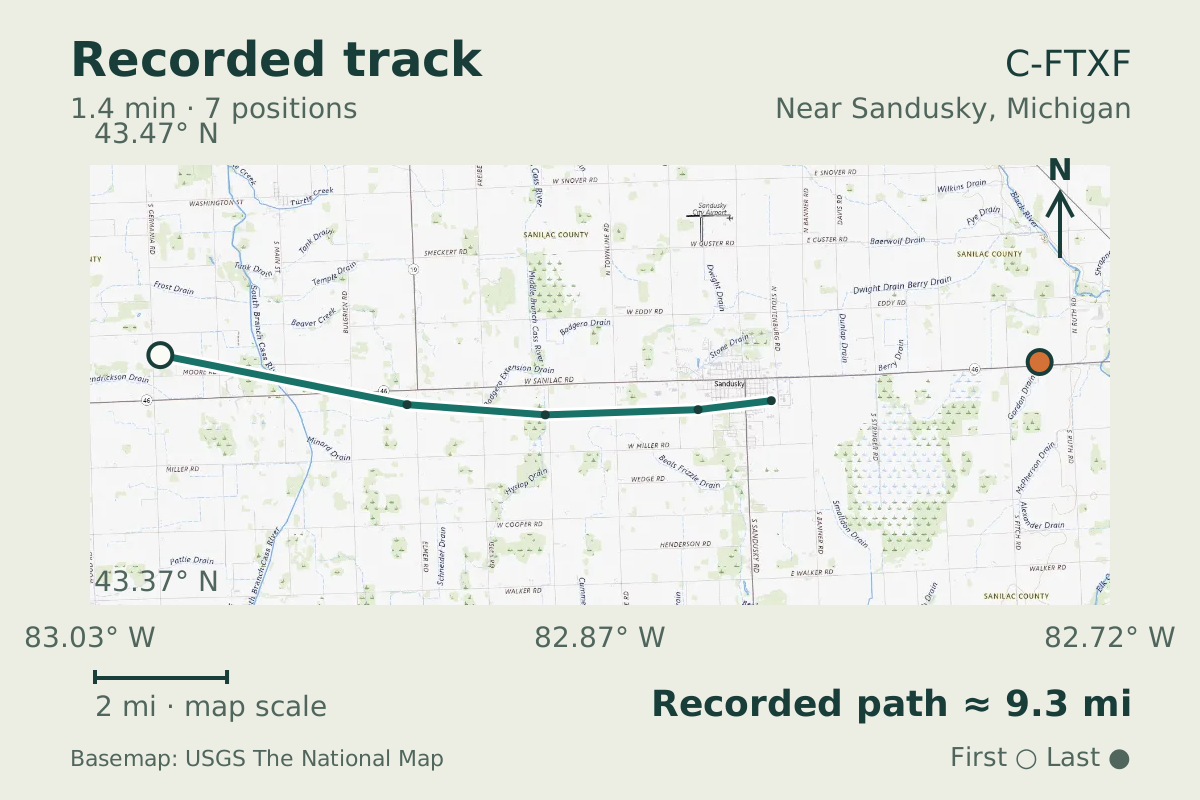
Boeing 737 MAX 8 C-FTXF shows a rapid descent
The October 31, 2026 observation carried callsign WJA640, whose WJA prefix is WestJet's designator.
- Replay time · UTC
- —
- Last saved report · UTC
- —
- Recorded path
- —
- Reported ground speed
- —
- Archived altitude
- —
The dot moves between saved positions. Readings are from the last saved report. Recorded path is approximate and excludes gaps. Distances use nautical miles (nmi); speed uses knots (nmi per hour).

C-FTXF reported a downward rate of about 4,700 ft/min near Sandusky, Michigan. The usual descent rate for an airliner is 2,000 to 3,500 ft/min. Pressure altitude fell from 34,500 to 31,000 feet. Its Boeing 737 MAX 8 identification comes from the aircraft database.
Descent rates vary with aircraft class, so a rapid descent is best read against the usual rates for its class. A fast descent in these reports is not an emergency determination. The average descent rate across the observed altitude change was about 2,500 ft/min.
Recorded data for C-FTXF
| Observed | to |
|---|---|
| Event type | Performance |
| Recorded source | ADS-B, ICAO address |
| Post date | |
| Last revised |
| Aircraft type | BOEING 737 MAX 8 |
|---|---|
| Type designator | B38M |
| Tail number (registration) | C-FTXF |
| Callsign | WJA640 |
| ICAO address | C03488 |
Measurements
Displayed measurements may be rounded.
- Peak signed vertical rate
- -4,736 ft/min
- the fastest rate in the episode; negative is down
- Observed altitude change
- -3,450 ft
- height lost or gained over the episode
- Episode duration
- 1 min 22.3 sec
- how long the detected episode lasted, which can be shorter than the saved track
- Ground speed
- 515.1 kn
- speed over the ground; wind adds to or subtracts from it
- Pressure altitude
- 34,475 ft
- pressure altitude, the figure pilots and controllers use
All measurements and the evidence record
| Ground speed | 515.1 kn |
|---|---|
| Pressure altitude | 34,475 ft |
| Geometric altitude | 35,425 ft |
| Pressure-altitude vertical rate | -4,736 ft/min |
| Navigation integrity category | 8 |
| Navigation accuracy category | 10 |
| Episode start altitude | 34,475 ft |
|---|---|
| Episode end altitude | 31,025 ft |
| Distinct reports after collapsing repeats | 7 samples |
| Episode duration | 82 s |
| Telemetry samples | 8 samples |
| Median rate of readings above the detection threshold | -4,736 ft/min |
| Average rate from the episode altitude change | -2,515.2 ft/min |
| Observed altitude change | -3,450 ft |
| Integrated reported altitude change | -4,695 ft |
| Peak signed vertical rate | -4,736 ft/min |
|---|
| Detection threshold (magnitude) | 4,500 ft/min |
|---|
| Duration of consecutive reports above the detection threshold | 50 s |
|---|---|
| Consecutive reports above the detection threshold | 4 samples |
Evidence version: ff649104762c2553.
Record details
Public event ID: ea17e336-7f0d-4d.
Record revision: 2.