Tail/type: current database matches; historical assignments unverified.
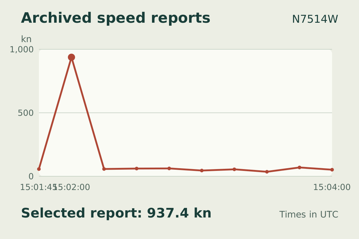
A saved ground-speed report reads 937.4 knots. The observation preserves that unusual reported value and the available surrounding readings; it does not establish the aircraft’s actual performance.
10 archived ground-speed readings around the selected value. Each dot is a saved report; lines stop at gaps over 45 seconds, source changes and rejected readings. Archive timestamps do not establish exact message freshness. The peak is an unconfirmed reported value, not verified aircraft performance.
Complete observation interval 12 Sept 2026 · 15:02:00 UTC
Aircraft details
Tail number
N7514W
Aircraft type
ROBINSON R-22 Mariner (R22)
Callsign
N7514W
ICAO address
AA20B9
Tail/type: current database matches; historical assignments unverified.
All recorded measurements
Saved report12 Sept 2026 · 15:02:00 UTC
Ground speed
937.4 kn
Archived altitude; reference not retained
1,650 ft
Transponder code
1200
Evidence and limitations
Aircraft metadata is a current database match; historical assignment is not independently verified.
MLAT estimates position from signal timing across receivers. Derived position and speed may not provide independent corroboration.
An outlying report alone does not establish an aircraft's performance or the cause of a data error.
10 archived ground-speed readings around the selected value. Each dot is a saved report; lines stop at gaps over 45 seconds, source changes and rejected readings. Archive timestamps do not establish exact message freshness. The peak is an unconfirmed reported value, not verified aircraft performance.
Tail/type: current database matches; historical assignments unverified.
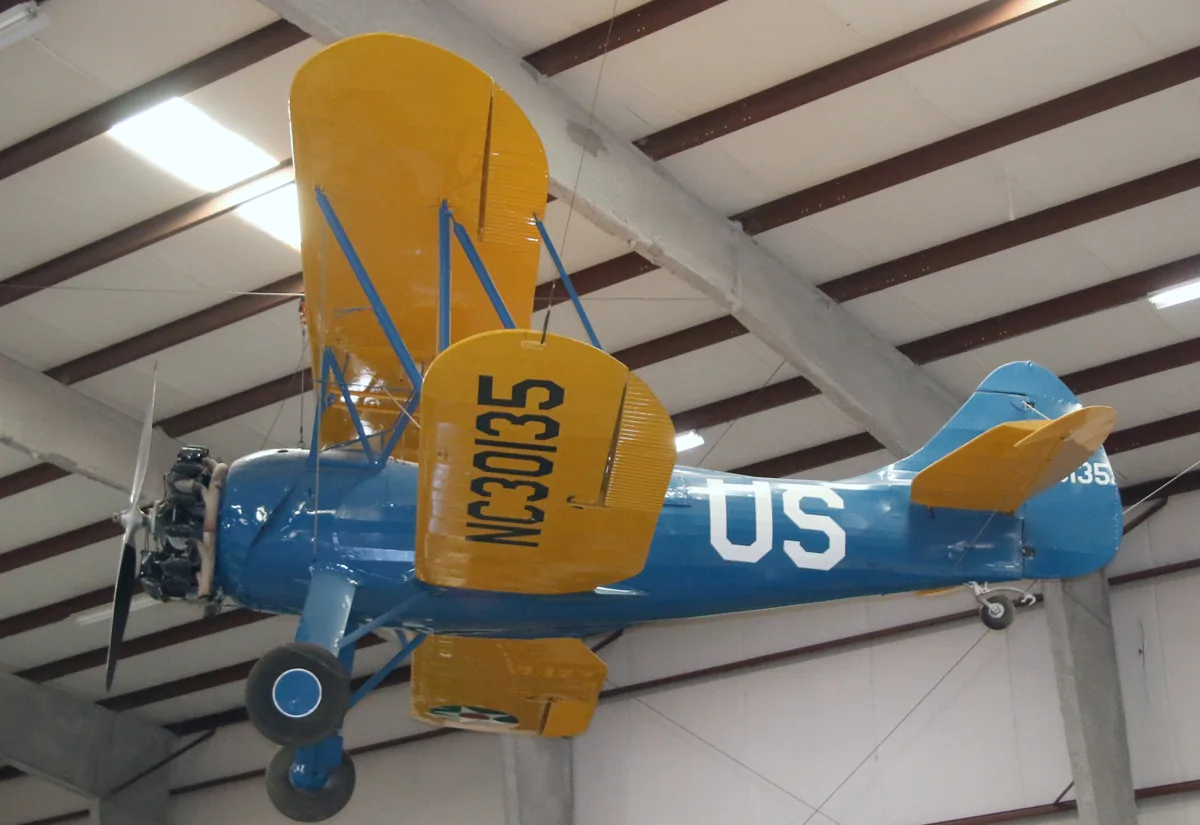
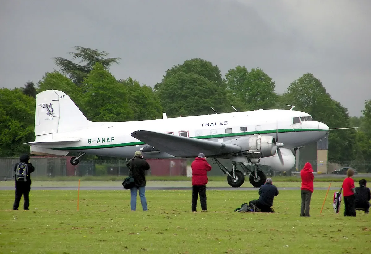
The saved aircraft database identifies this aircraft as DOUGLAS DC-3 Dakota. The type match does not independently verify its historical assignment or the purpose of this flight.
Tail/type: current database matches; historical assignments unverified.
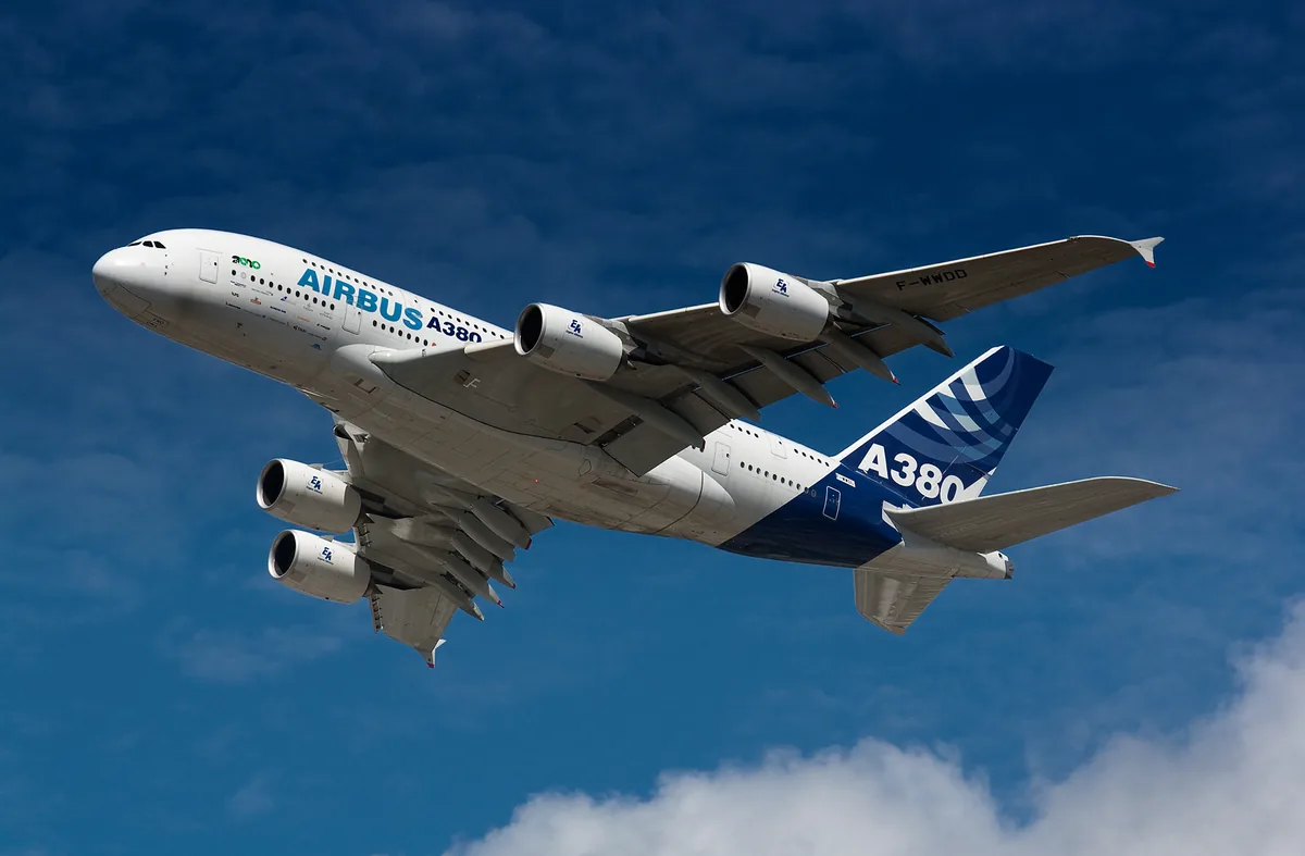
The saved aircraft database identifies this aircraft as AIRBUS A-380-800. The type match does not independently verify its historical assignment or the purpose of this flight.
Tail/type: current database matches; historical assignments unverified.
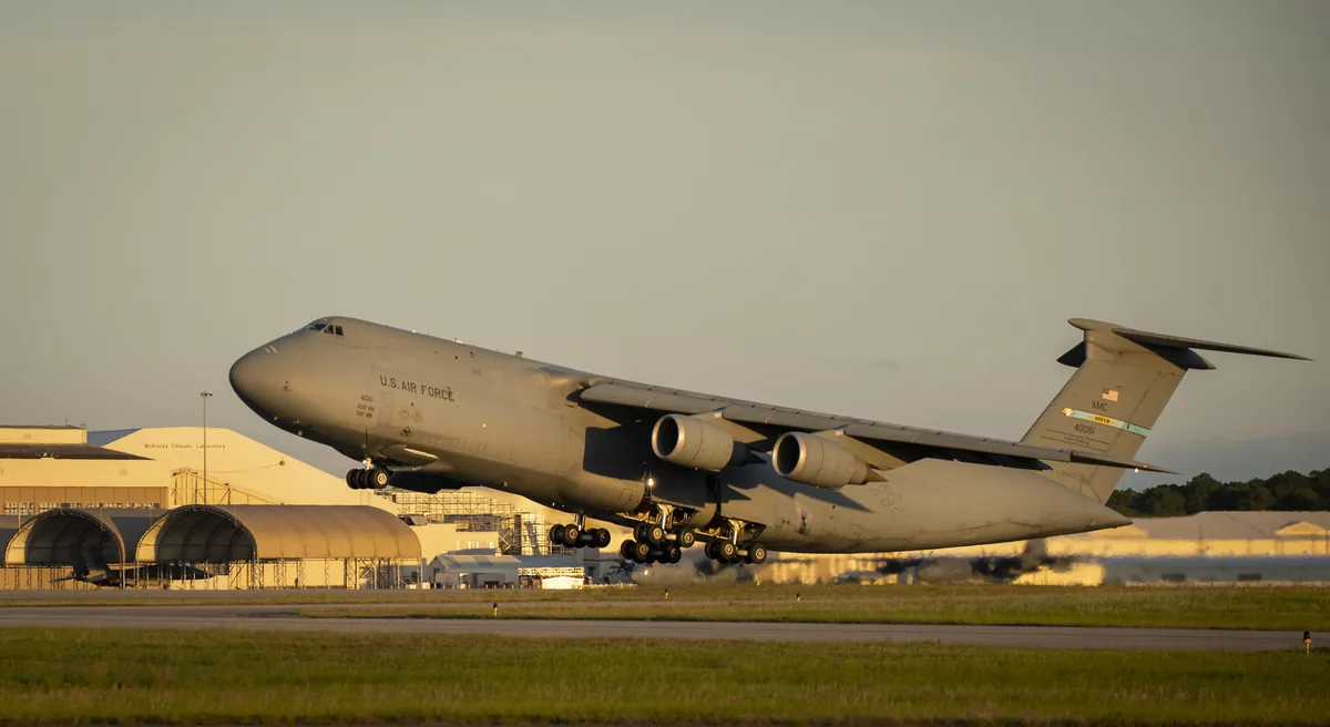
The saved aircraft database identifies this aircraft as Lockheed C-5M Super Galaxy. The type match does not independently verify its historical assignment or the purpose of this flight.
Tail/type: current database matches; historical assignments unverified.
The saved aircraft database identifies this aircraft as E6. The type match does not independently verify its historical assignment or the purpose of this flight.
The dot moves between saved positions. Readings are from the last saved report. Recorded path is approximate and excludes gaps. Distances use nautical miles (nmi); speed uses knots (nmi per hour).
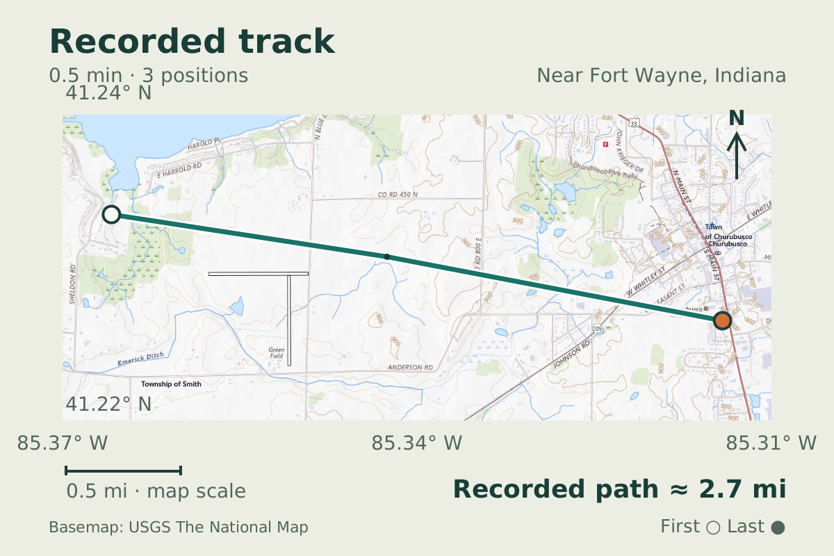
Geographic plot of 3 saved aircraft positions in a short archived excerpt (Near Fort Wayne, Indiana). About 2.7 miles (2.4 nautical miles) along the plotted segments. Lines stop at gaps over 45 seconds, source changes and rejected positions. Archive timestamps do not establish exact message freshness. USGS topographic background shows roads, water and place names where available. It is a current reference map, not imagery from the flight date. Map data sources
Complete observation interval 8 Sept 2026 · 19:11:30 UTC to 8 Sept 2026 · 19:16:00 UTC
Aircraft details
Tail number
Not recorded
Aircraft type
E6
Callsign
Not recorded
ICAO address
AE8B78
Tail/type: current database matches; historical assignments unverified.
All recorded measurements
Saved report8 Sept 2026 · 19:11:30 UTC
Archived altitude; reference not retained
27,000 ft
Transponder code
0000
Evidence and limitations
Aircraft metadata is a current database match; historical assignment is not independently verified.
MLAT estimates position from signal timing across receivers. Derived position and speed may not provide independent corroboration.
Geographic plot of 3 saved aircraft positions in a short archived excerpt (Near Fort Wayne, Indiana). About 2.7 miles (2.4 nautical miles) along the plotted segments. Lines stop at gaps over 45 seconds, source changes and rejected positions. Archive timestamps do not establish exact message freshness. USGS topographic background shows roads, water and place names where available. It is a current reference map, not imagery from the flight date.
Tail/type: current database matches; historical assignments unverified.
The saved aircraft database identifies this aircraft as BOEING 747-400LCF Dreamlifter. The type match does not independently verify its historical assignment or the purpose of this flight.